Smart Farming NI | How Drones Can Help Identify Farm Drainage Problems July 2026
Smart Farming NI | How Drones Can Help Identify Farm Drainage Problems July 2026
Drainage issues can often go unnoticed until they begin affecting grazing land, access routes and wider field conditions.
Standing water, poor runoff and saturated ground can create long-term problems for farms if left unchecked.
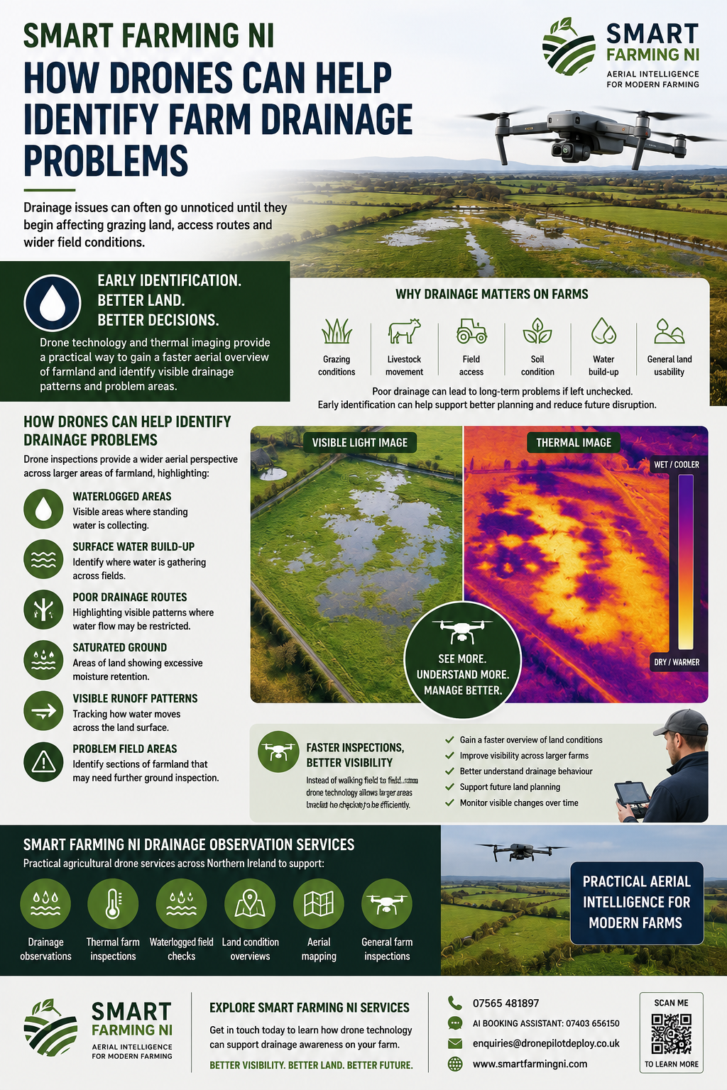
At Smart Farming NI, drone technology and thermal imaging provide a practical way to gain a faster aerial overview of farmland, helping identify visible drainage patterns and potential problem areas.
This can support better land awareness and help farmers understand how water is affecting their land.
Why Drainage Matters on Farms
Poor drainage can impact:
- Grazing conditions
- Livestock movement
- Field access
- Soil condition
- Water build-up
- General land usability
Over time, drainage issues can lead to wider land management challenges.
Early identification can help support better planning and reduce future disruption.
How Drone Technology Can Help
Drone inspections provide a wider aerial perspective across larger areas of farmland.
This can help highlight:
Waterlogged Areas
Visible areas where standing water is collecting.
Surface Water Build-Up
Identifying where water is gathering across fields.
Poor Drainage Routes
Highlighting visible patterns where water flow may be restricted.
Saturated Ground
Areas of land showing excessive moisture retention.
Visible Runoff Patterns
Tracking how water moves across the land surface.
Problem Field Areas
Identifying sections of farmland that may need further ground inspection.
Faster Inspections, Better Visibility
Instead of walking field to field, drone technology allows larger areas to be checked more quickly and efficiently.
This can help farmers:
- Gain a faster overview of land conditions
- Improve visibility across larger farms
- Better understand drainage behaviour
- Support future land planning
- Monitor visible changes over time
Drone technology provides practical aerial intelligence for modern farm management.
Smart Farming NI Drainage Observation Services
At Smart Farming NI, we provide practical agricultural drone services across Northern Ireland to support:
✅ Drainage observations
✅ Thermal farm inspections
✅ Waterlogged field checks
✅ Land condition overviews
✅ Aerial mapping
✅ General farm inspections
Whether you need a wider overview of your land or want to investigate visible drainage issues, drone inspections can provide practical support.
Explore Smart Farming NI Agricultural Drone Services
If you would like to learn more about how drone technology can support drainage awareness on your farm, get in touch today.
Smart Farming NI provides practical agricultural drone services across Northern Ireland, helping farmers gain better aerial visibility of their land.
Robert Dobbin
Agricultural Drone Intelligence, Thermal & 3D Mapping Specialist
📱
07565 481897
📞
AI Booking Assistant: 07403 656150
📧
enquiries@dronepilotdeploy.co.uk
The body content of your post goes here. To edit this text, click on it and delete this default text and start typing your own or paste your own from a different source.