
Smart Farming NI | How 3D Land Models Can Help Farmers Better Understand Their Land July 2026
How 3D Land Models Can Help Farmers Better Understand Their Land
Understanding the shape, layout and structure of farmland from the ground can often be difficult — especially across larger or more complex land areas.
This is where drone-generated 3D land models can provide valuable insight.
At Smart Farming NI, I use drone technology to create detailed 3D land models and aerial maps, helping farmers and landowners across Northern Ireland gain a clearer understanding of their land.
These models provide a practical aerial view that can support inspections, land awareness and future planning.
What Is a 3D Land Model?
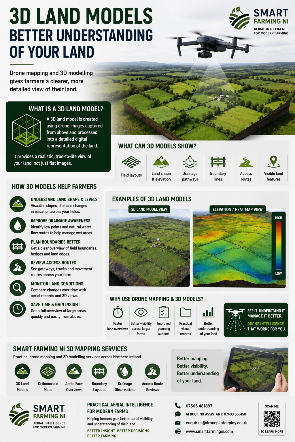
A 3D land model is created using multiple drone images captured from above and processed into a detailed digital representation of the land.
This can provide a visual model of:
- Field layouts
- Land shape
- Surface levels
- Boundary lines
- Access routes
- Visible drainage paths
Instead of viewing land in flat images alone, 3D models provide a more realistic understanding of how the land is structured.
How Can 3D Models Help Farmers?
Drone-generated 3D models can support a better understanding of:
Land Shape and Levels
Helping visualise slopes, dips and changes in elevation.
Drainage Awareness
Showing visible low points and natural water flow routes.
Boundary Planning
Providing a wider overview of field boundaries and land edges.
Access Route Visibility
Reviewing gateways, tracks and movement routes across farmland.
Land Condition Monitoring
Creating useful aerial records to compare land conditions over time.
Why Use 3D Drone Mapping?
Traditional ground inspections can only show part of the picture.
Drone-generated 3D models allow larger areas to be captured quickly and turned into useful visual land data.
Benefits can include:
- Better visibility across larger farms
- Faster land overviews
- Improved planning support
- Practical visual records
- Better understanding of land conditions
This can be particularly useful for larger farms where gaining a full overview on foot takes time.
Smart Farming NI 3D Mapping Services
At Smart Farming NI, I provide practical drone mapping and 3D land modelling services across Northern Ireland.
My services can support:
✅ 3D land models
✅ Orthomosaic maps
✅ Aerial farm overviews
✅ Boundary layouts
✅ Drainage observations
✅ Access route reviews
Whether you are reviewing land conditions, planning improvements or simply looking to gain a better understanding of your farm, drone mapping can provide practical aerial support.
Explore Smart Farming NI Mapping Services
If you would like to learn more about drone mapping or 3D land models, get in touch today.
Smart Farming NI provides practical agricultural drone services across Northern Ireland, helping farmers gain better aerial visibility and understanding of their land.
Robert Dobbin
Agricultural Drone Intelligence, Thermal & 3D Mapping Specialist
📱
07565 481897
📞
AI Booking Assistant: 07403 656150
📧
enquiries@dronepilotdeploy.co.uk
The body content of your post goes here. To edit this text, click on it and delete this default text and start typing your own or paste your own from a different source.